
 Tweet
Tweet
On another topic I elaborated something... and then I got this idea!
How would it be, what would be gained; to add the ability to measure the earth's magnetic field to a modern metal detector.
A completely independent part, one can say "magnetometer", which will constantly monitor changes in the earth's magnetic field,
constantly "adding" that data to the algorithm for monitoring and adjusting the GEB.
Once, until just 10 years ago, this would have been a serious engineering task.
Today, with such rapid development of technology, this has become a very easy task.
Here I do not immediately mean the automatic GEB or "tracking" option.
Of course, the detector should have a rich variety of GEB options and behaviors.
But such data from the "magnetometer" part of the detector should always be included in the "equation" with GEB,
whether the user has chosen the manual GEB mode or the auto-tracking mode.
This is a kind of complication of the whole story. Now we need to design relations of such data with conventional GEB functions.
But we will agree that GEB is actually the most important function on the detector and that everything else depends on it.
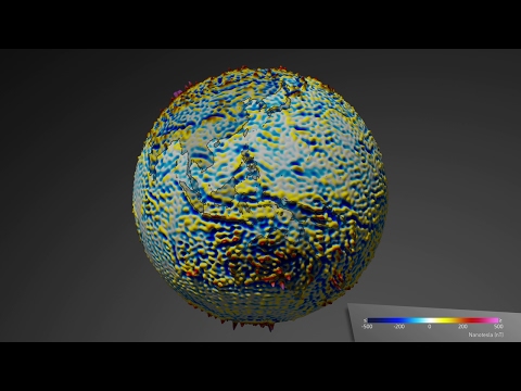
And the reference values for magnetometry are already known. They can vary within a small range.
And there is also the option of setting initial reference values at the very beginning of working with the detector.
How would this contribute to the quality of work with the detector?
I have changed many models and types of detectors over the years.
There are a couple of models that remain in the memory for some functions, which proved to be vital for progress.
I will always have in my subconscious White's Eagle, the whole series, where the initial function was Air/Ground balancing.
That's where it all started for me, the real deal, real detector work.
You adjust the "range" of the GEB, turn off the AIR signals and set the reference.
I imagine what it would be like to add to that the influence of the sun, the condition, the strength of the magnetic field on the surface of the soil.
Indirectly, this is already implied by the GEB setting itself.
And then during work, when conditions in the soil suddenly change, not in mineralization, not in soil moisture,
but only in case of sudden changes in the strength and polarity of the magnetic field; things get drastically worse (rarely better) in detector behavior.
This would be especially useful in the situations I already described on another topic.
Pointy, narrow hills, where there used to be an ancient fort, later for one reason or another the fort was demolished, the material was pushed down the slopes in irregular amounts.
A huge amount of valuable metal finds are buried there at various depths.
A huge amount of coins are found in such places.
The BIGGEST obstacle (in my practice) is not the majority of the composition of such soil.
Teh BIGGEST obstacle are randomly present stones, pieces of material, which have strong magnetic properties. Some would call it "hot rock".
The detector works quite well, uniformly... and suddenly when you come across such a place; the detector suddenly "goes crazy".
The masking effect in such places is intractable.
Insurmountable.
Even the best detectors in this matter, with the fastest recovery speed/reactivity... are not able to overcome this problem.
Aware of this problem, I am often provoked to "blindly", randomly, dig up those surfaces, remove a large part of the material...
and very often I randomly find very valuable coins of silver, less often of gold, which were heavily masked, even it is impossible to detect them at depths of 5 cm.
The easiest way to describe this is on the example of GEB at Deus.
Up to that point, the GEB on the Deus was, for example, set to 79. And a step further, above such a point, the GEB suddenly jumps to 88-89!
Since version 3.2 on Deus, they have changed something in the firmware, which bothers me a lot and I can't manage, so the GEB reading behaves more inert and slower.
At such places the GEB reading on the Deus simply disappears?? And for a few minutes I don't have information about GEB on the display.
Then it appears briefly, for a second or two, it disappears again. Even in such situations, the GEB data on the display does not exist and there is no use of that function.
The audio behaves crazy, the detector "breathes", there is no VDI number, from practice it is clear to me what it is about.
The problem today is the lack of new sites, I have the impression that all sites have already been discovered and well researched.
The detectorist has no idea where to go anymore.
And at the same time, I am 110% sure that there are MANY valuable finds left in such places, undiscovered.
The problem is that there are a lot of such areas in such places. On some hills, over 50% of the area is like this.
I have carried many detector models in such places. Even the ML GPX 5000.
There is simply no help.
Nothing known so far solves the problem.
Ok, the ML GPX 5000 is still a bit of an exception, it manages to "break through" the heavy mask in a smaller percentage.
But the detector itself is huge, clumsy, heavy, it is impossible to work with it in such places.
How to overcome it? Such places?
I also noticed that during the day, such places are either "tame" or more "wild". Depending on the time of day and the influence of the sun.
But it is difficult, almost impossible, to predict a minute, an hour, during the day, when the detector will behave more calmly in that place.
Therefore, I am of the opinion that some additional "mechanism" on the detector is needed for such situations.
It all boils down to the magnetometer and the inclusion of such data in the operation of the detector.
Here is one that seems to me to be an original idea for engineers.
How would it be, what would be gained; to add the ability to measure the earth's magnetic field to a modern metal detector.
A completely independent part, one can say "magnetometer", which will constantly monitor changes in the earth's magnetic field,
constantly "adding" that data to the algorithm for monitoring and adjusting the GEB.
Once, until just 10 years ago, this would have been a serious engineering task.
Today, with such rapid development of technology, this has become a very easy task.
Here I do not immediately mean the automatic GEB or "tracking" option.
Of course, the detector should have a rich variety of GEB options and behaviors.
But such data from the "magnetometer" part of the detector should always be included in the "equation" with GEB,
whether the user has chosen the manual GEB mode or the auto-tracking mode.
This is a kind of complication of the whole story. Now we need to design relations of such data with conventional GEB functions.
But we will agree that GEB is actually the most important function on the detector and that everything else depends on it.
And the reference values for magnetometry are already known. They can vary within a small range.
And there is also the option of setting initial reference values at the very beginning of working with the detector.
How would this contribute to the quality of work with the detector?
I have changed many models and types of detectors over the years.
There are a couple of models that remain in the memory for some functions, which proved to be vital for progress.
I will always have in my subconscious White's Eagle, the whole series, where the initial function was Air/Ground balancing.
That's where it all started for me, the real deal, real detector work.
You adjust the "range" of the GEB, turn off the AIR signals and set the reference.
I imagine what it would be like to add to that the influence of the sun, the condition, the strength of the magnetic field on the surface of the soil.
Indirectly, this is already implied by the GEB setting itself.
And then during work, when conditions in the soil suddenly change, not in mineralization, not in soil moisture,
but only in case of sudden changes in the strength and polarity of the magnetic field; things get drastically worse (rarely better) in detector behavior.
This would be especially useful in the situations I already described on another topic.
Pointy, narrow hills, where there used to be an ancient fort, later for one reason or another the fort was demolished, the material was pushed down the slopes in irregular amounts.
A huge amount of valuable metal finds are buried there at various depths.
A huge amount of coins are found in such places.
The BIGGEST obstacle (in my practice) is not the majority of the composition of such soil.
Teh BIGGEST obstacle are randomly present stones, pieces of material, which have strong magnetic properties. Some would call it "hot rock".
The detector works quite well, uniformly... and suddenly when you come across such a place; the detector suddenly "goes crazy".
The masking effect in such places is intractable.
Insurmountable.
Even the best detectors in this matter, with the fastest recovery speed/reactivity... are not able to overcome this problem.
Aware of this problem, I am often provoked to "blindly", randomly, dig up those surfaces, remove a large part of the material...
and very often I randomly find very valuable coins of silver, less often of gold, which were heavily masked, even it is impossible to detect them at depths of 5 cm.
The easiest way to describe this is on the example of GEB at Deus.
Up to that point, the GEB on the Deus was, for example, set to 79. And a step further, above such a point, the GEB suddenly jumps to 88-89!
Since version 3.2 on Deus, they have changed something in the firmware, which bothers me a lot and I can't manage, so the GEB reading behaves more inert and slower.
At such places the GEB reading on the Deus simply disappears?? And for a few minutes I don't have information about GEB on the display.
Then it appears briefly, for a second or two, it disappears again. Even in such situations, the GEB data on the display does not exist and there is no use of that function.
The audio behaves crazy, the detector "breathes", there is no VDI number, from practice it is clear to me what it is about.
The problem today is the lack of new sites, I have the impression that all sites have already been discovered and well researched.
The detectorist has no idea where to go anymore.
And at the same time, I am 110% sure that there are MANY valuable finds left in such places, undiscovered.
The problem is that there are a lot of such areas in such places. On some hills, over 50% of the area is like this.
I have carried many detector models in such places. Even the ML GPX 5000.
There is simply no help.
Nothing known so far solves the problem.
Ok, the ML GPX 5000 is still a bit of an exception, it manages to "break through" the heavy mask in a smaller percentage.
But the detector itself is huge, clumsy, heavy, it is impossible to work with it in such places.
How to overcome it? Such places?
I also noticed that during the day, such places are either "tame" or more "wild". Depending on the time of day and the influence of the sun.
But it is difficult, almost impossible, to predict a minute, an hour, during the day, when the detector will behave more calmly in that place.
Therefore, I am of the opinion that some additional "mechanism" on the detector is needed for such situations.
It all boils down to the magnetometer and the inclusion of such data in the operation of the detector.
Here is one that seems to me to be an original idea for engineers.


Comment